New: I’m moving all the portfolio to a new location. There are empty templates, millioñes de typos, duplicates entries, and a lot of 404 errors. Doing this in my spare time so please be patient.
05 — Portfolio
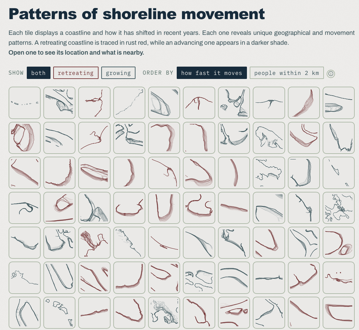
Explore how Pacific coastlines have changed over the past 20 years and the populations exposed to shoreline retreat.
Glyph Forge builds personalised mark from any icon or a few letters — set inside a polygon you control (used in the website). Export it as an SVG that scales to any size…
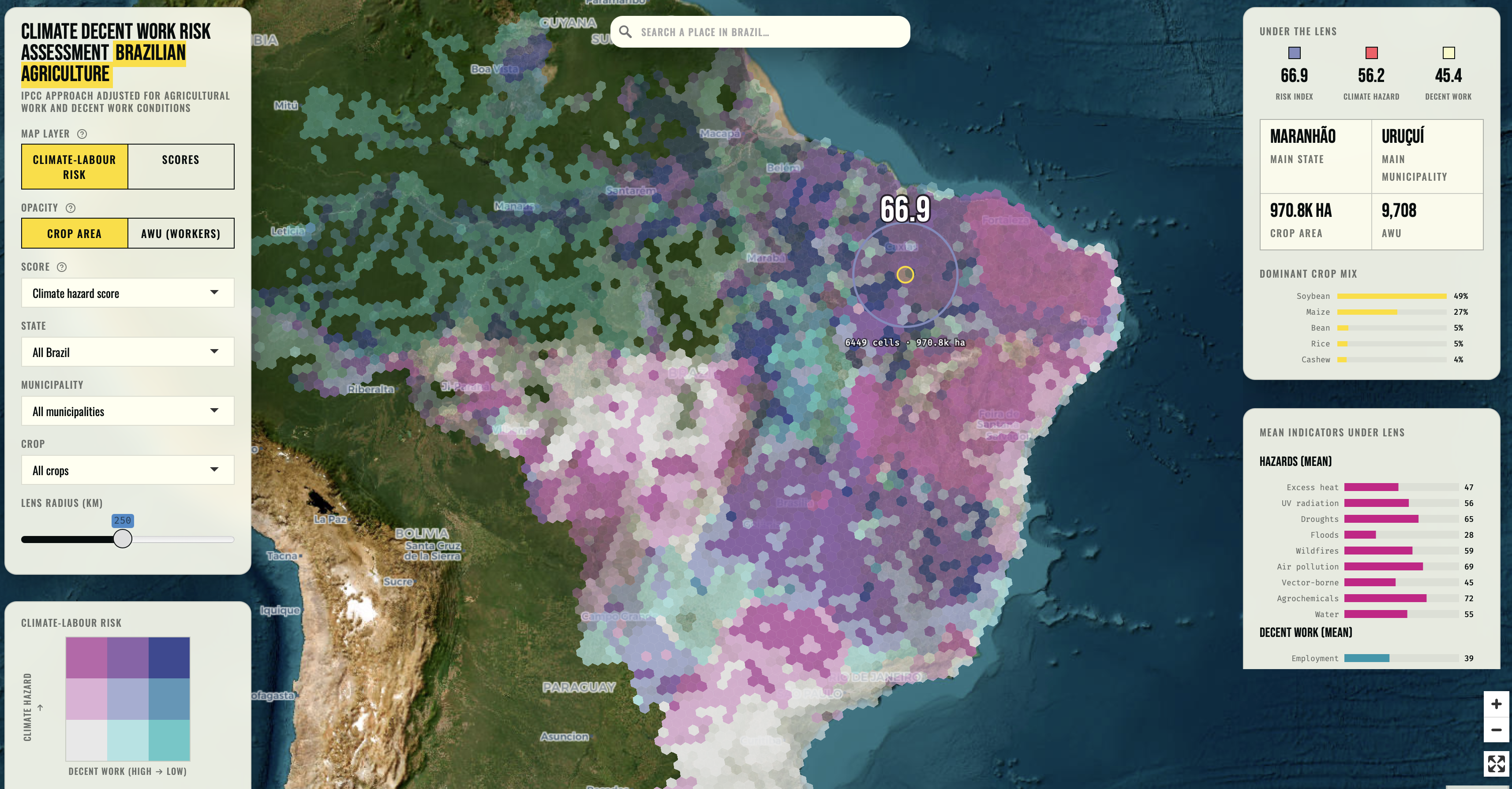
A web map of climate-labour risk in Brazilian agriculture. Each hexagon combines a climate hazard score with a decent work score; filter by state, municipality or crop, and…
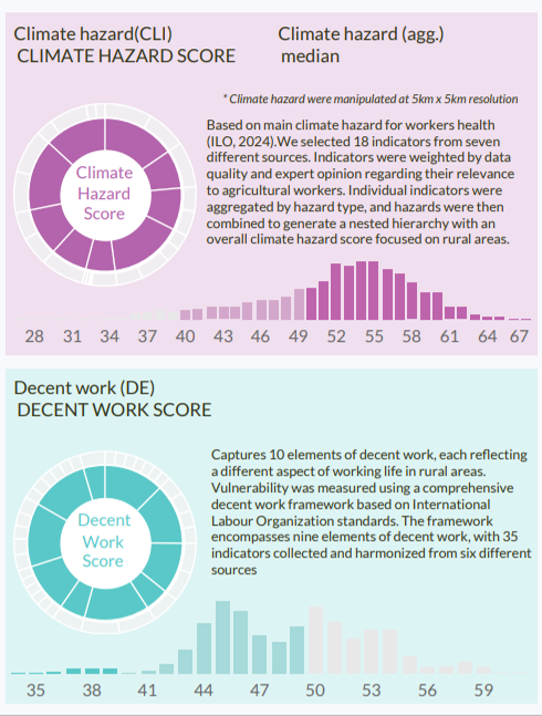
Integrated risk scores across Brazil’s 5,570 municipalities combining 23 climate hazard indicators and 35 decent work indicators at 0.05-degree spatial resolution. Follows…
Interactive Tableau dashboard combining IPCC-framework climate hazards with ten decent work indicators across Brazilian agricultural municipalities.
Occupational health surveillance data (2003–2024) for agricultural workers in Brazil, covering work-related accidents, climate-linked hospital admissions, dengue…
Infographic on agrochemical exposure risk across Brazilian agriculture — scored by pesticide application intensity and toxicity, disaggregated by municipality, population…
R script that downloads and tidies the World Bank ThinkHazard! dataset, filtering eight natural hazard types down to Brazil-specific records for analysis.
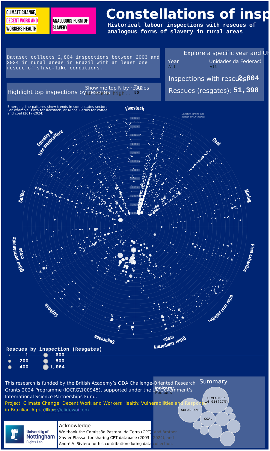
Each star is a labour inspection in Brazil — sized by workers rescued. A data visualisation of enforcement capacity and the scale of the task ahead.
Public website for a British Academy-funded project on climate change, occupational health, and decent work in Brazilian agriculture. Contains datasets, visualisations, R…
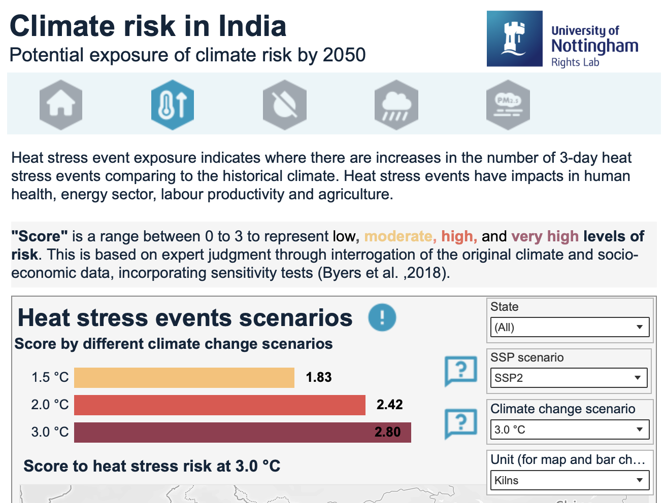
Training resource on environmental and labour risks for workers in India’s brick kiln and garment sectors. Available in English, Hindi, Punjabi, and Bengali.
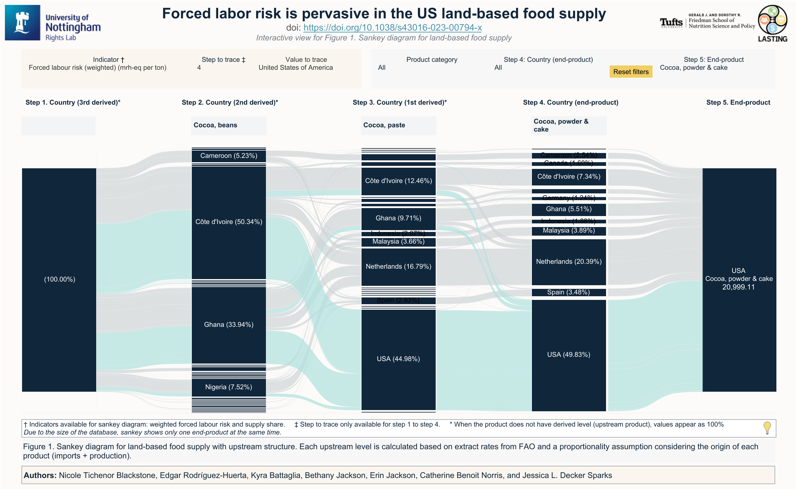
Supply shares, risk scores, and data quality assessment underlying Blackstone et al. (2023, Nature Food). Covers US land-based food commodities by ingredient origin country…
Interactive Tableau visualisations expanding on Blackstone et al. (2023, Nature Food). Explore forced labour risk by commodity, country of origin, and supply chain stage.
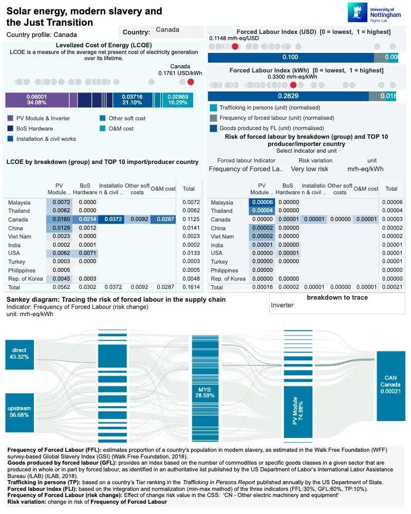
Country-level profiles comparing social-ecological sustainability indicators across key producer nations, built to support the Solar Energy, Modern Slavery, and the Just…
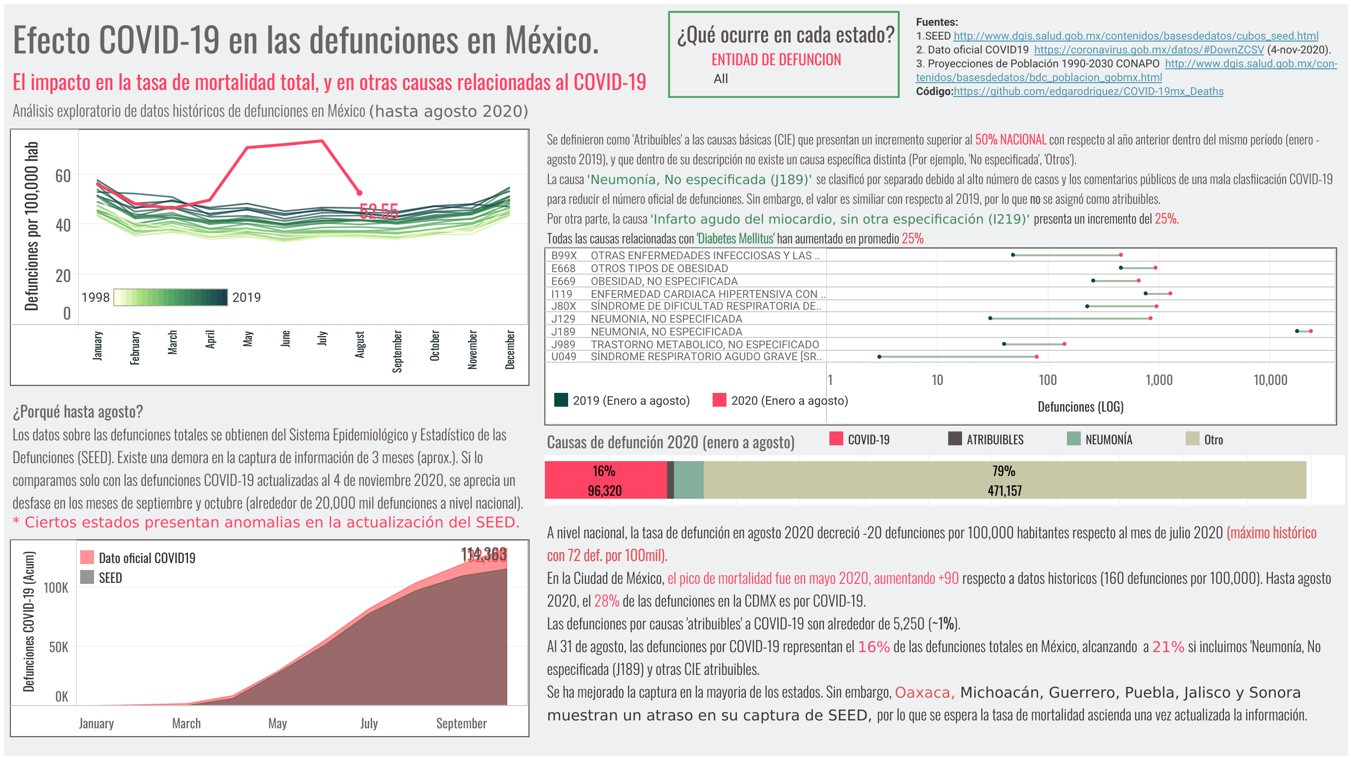
COVID-19 deaths and excess mortality across Mexican states, 2020. Draws on the national epidemiological death registry (SEED) to compare 2020 mortality rates against…
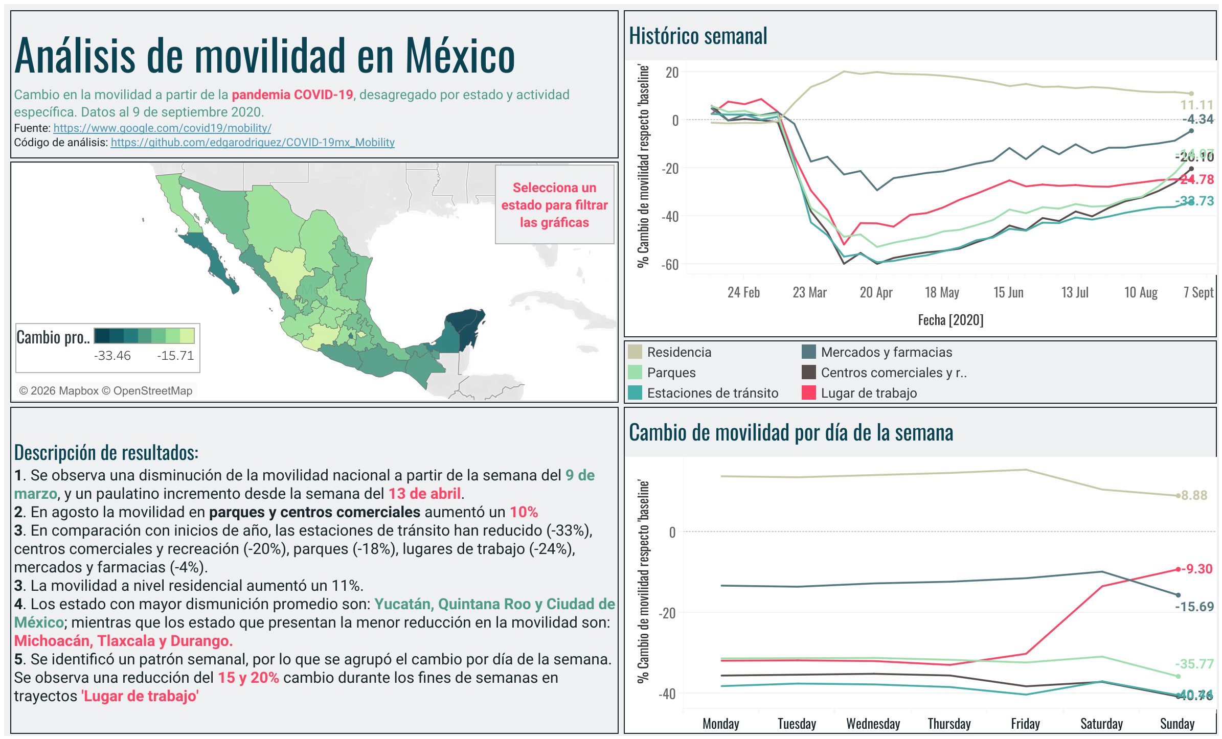
Mobility patterns across Mexican states during the COVID-19 pandemic, showing changes in movement relative to pre-pandemic baselines. Draws on aggregated mobility data to…
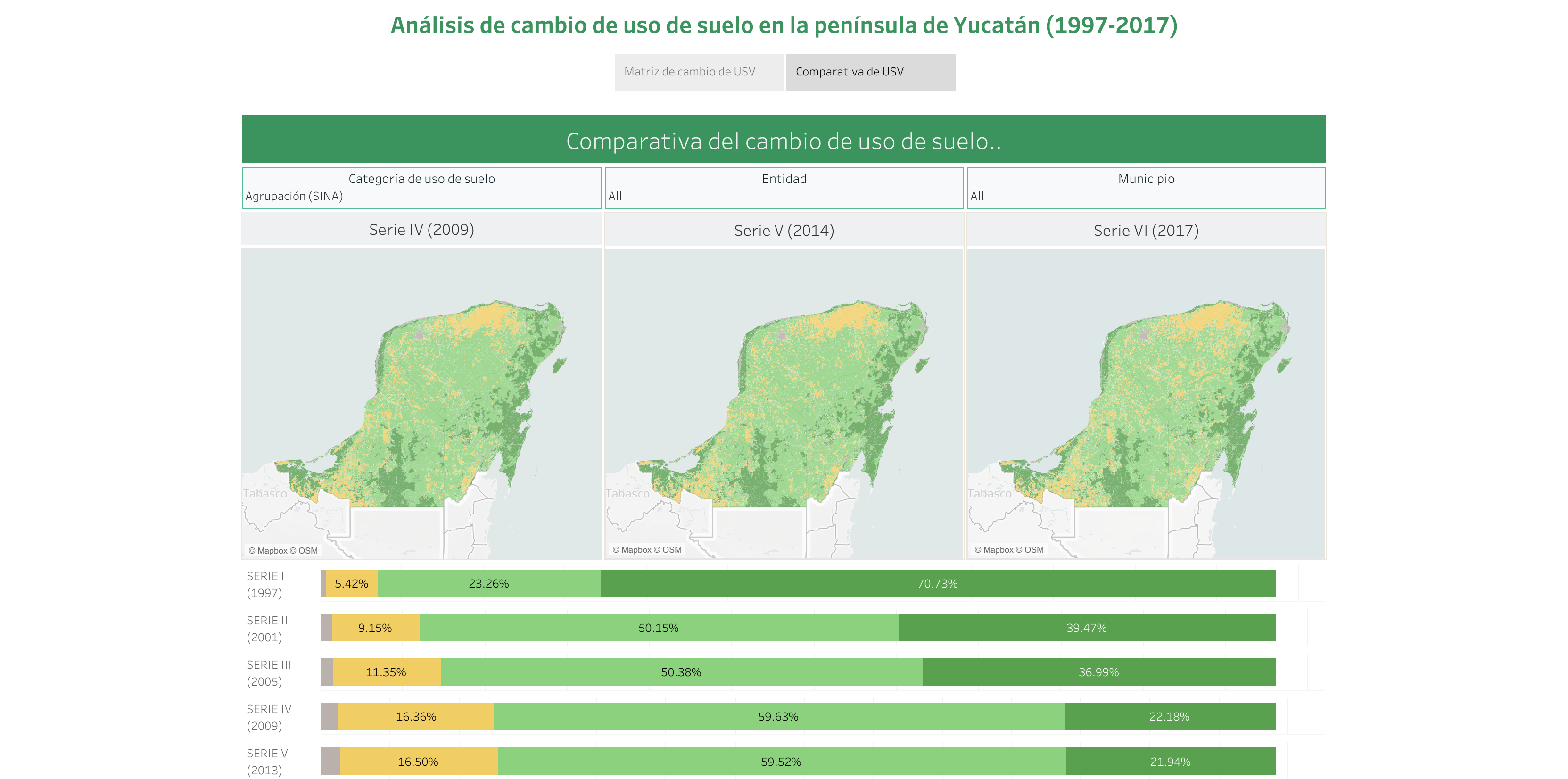
Six decades of land use and vegetation change in the Yucatán Peninsula using INEGI’s official mapping series (Series I to VI). Shows the pace and geography of deforestation…
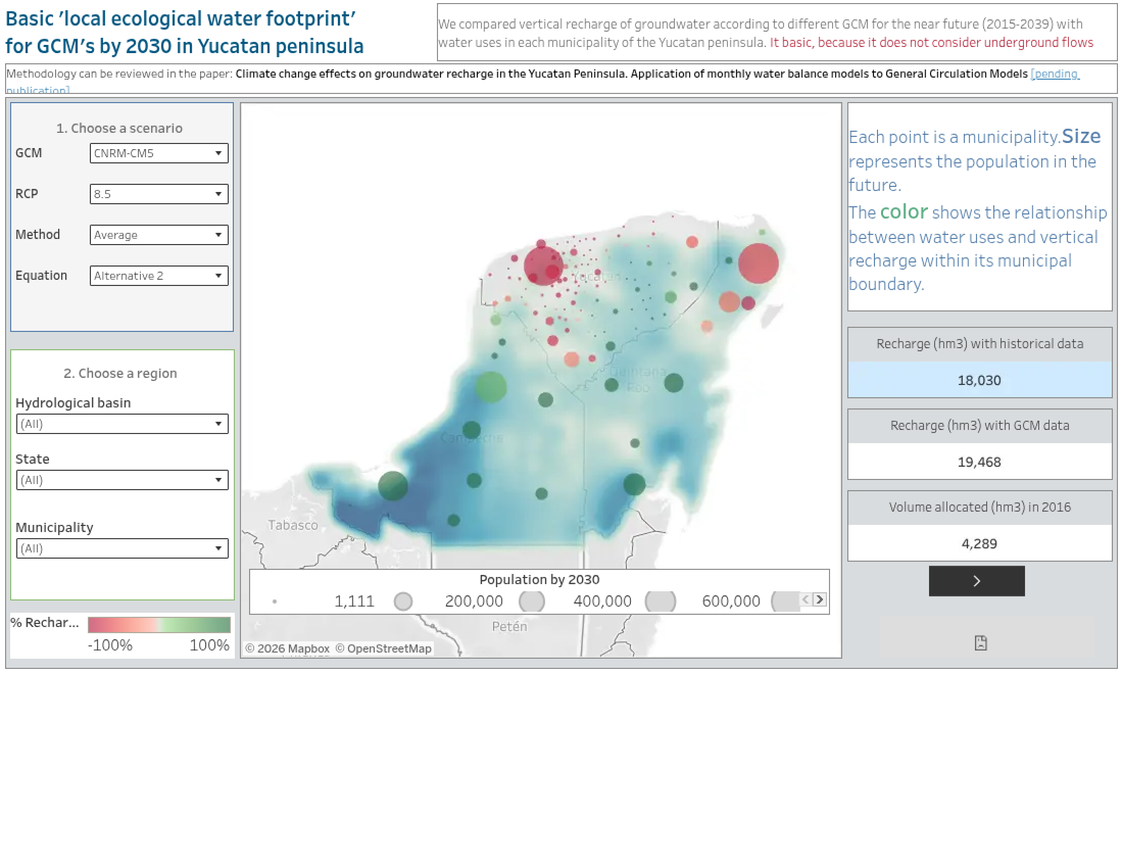
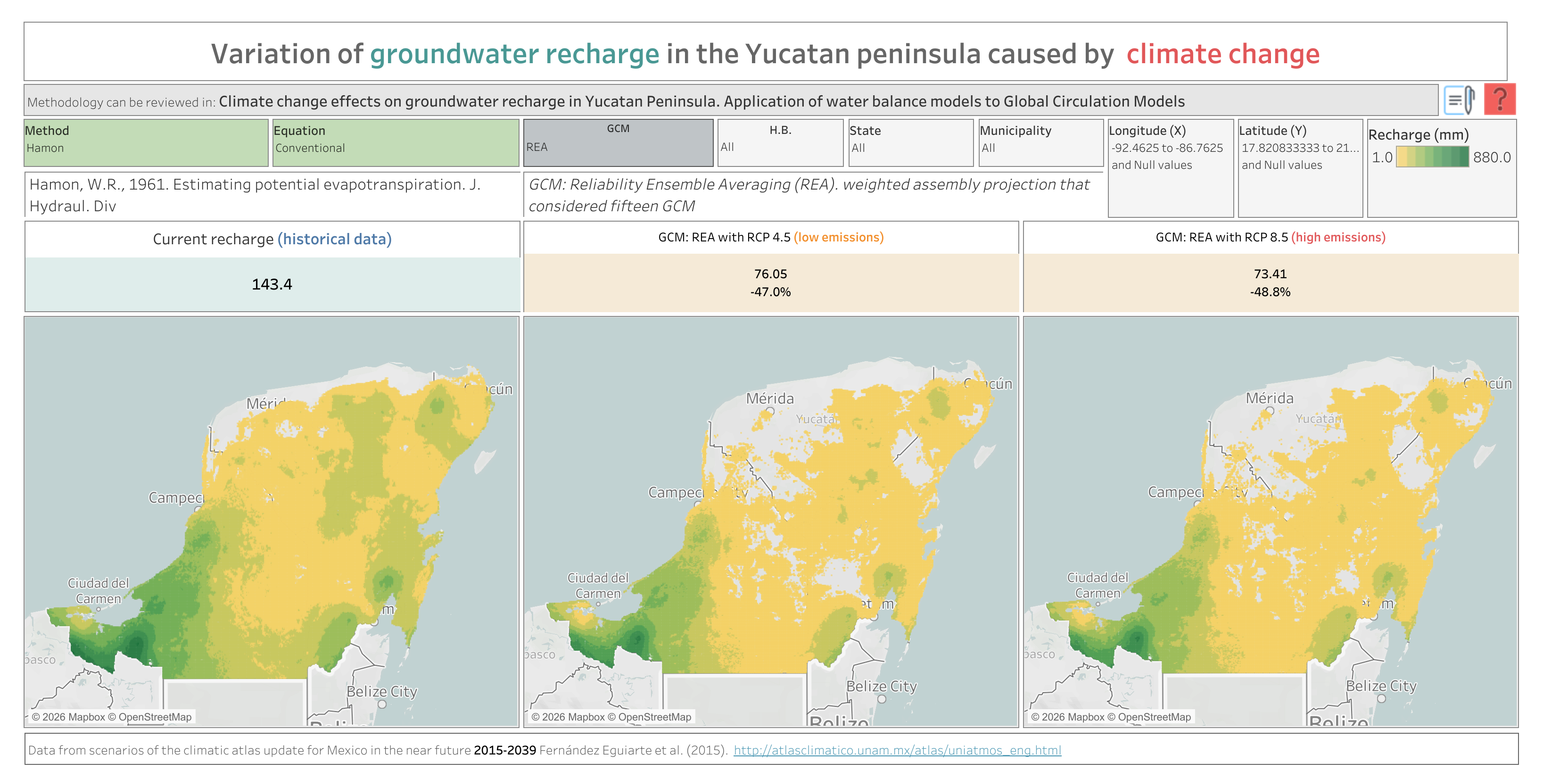
Water balance dashboard comparing total water demand against natural groundwater recharge across the Yucatán Peninsula, including projections to 2030 under different climate…
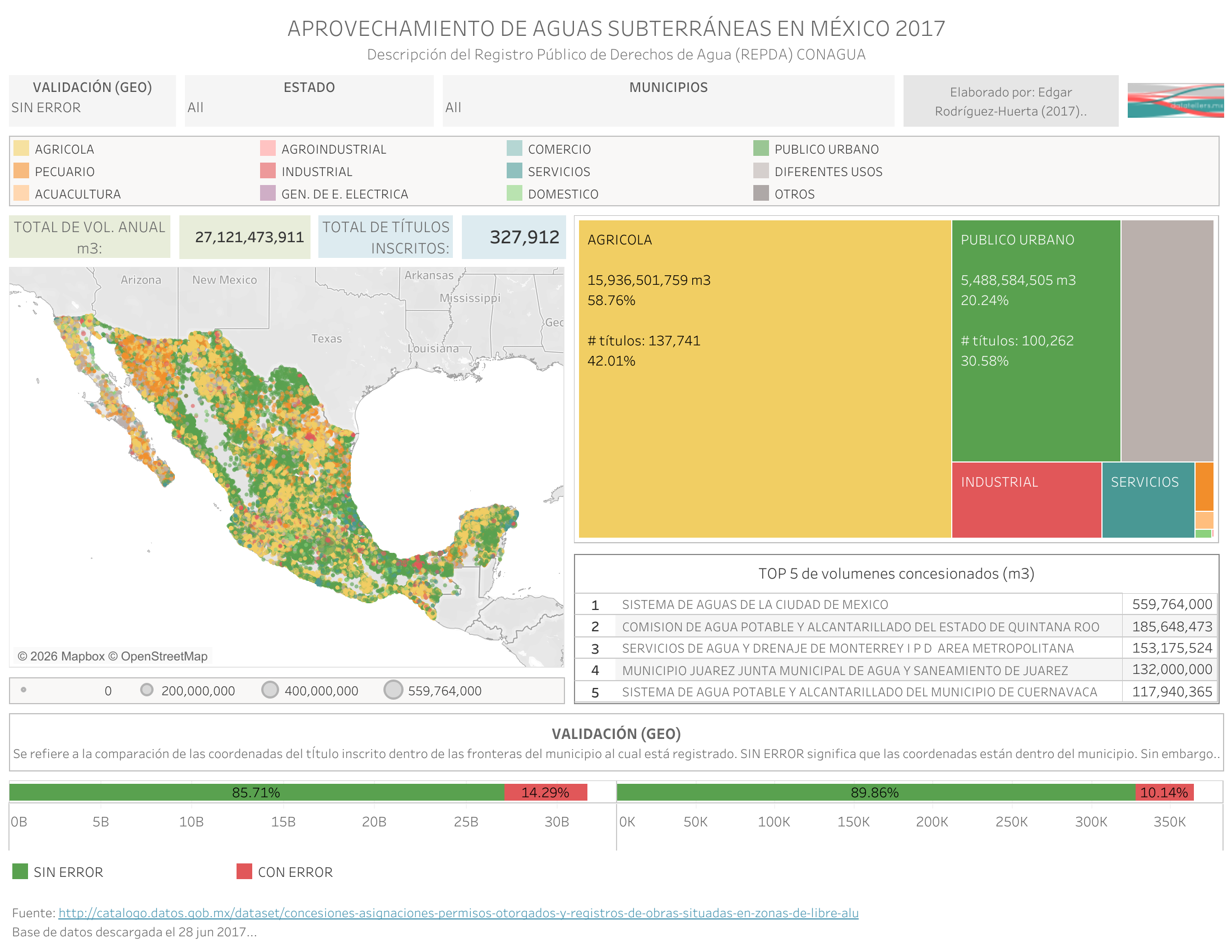
National distribution of water concessions from Mexico’s Public Registry of Water Rights (REPDA), 2017. Shows allocated volumes by state, usage type, and source (surface…
Estimated actual evapotranspiration (ETa) across the Yucatán Peninsula derived from the monthly water balance model. Shows how much water the land surface returns to the…
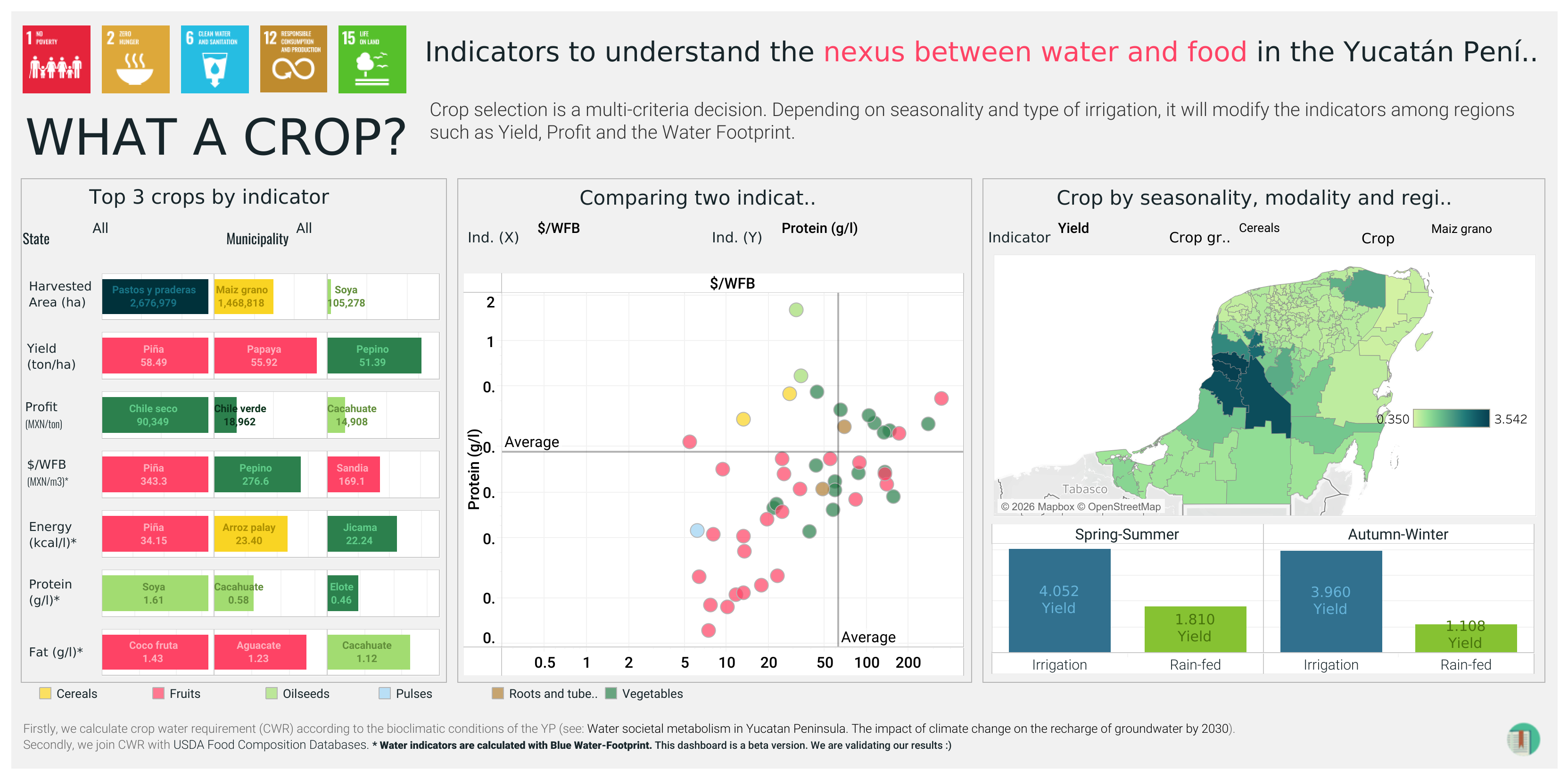
Interactive explorer for edible crop data, built for the EDIBLE project. Browse crops by type, region, nutritional characteristics, and production scale to understand the…